Vodafone’s pioneering ‘Network as a Sensor’ technology is being used to forecast rainfall and other weather conditions at a micro-climate level to alert people and first responders of flooding, and other natural and man-made dangers.
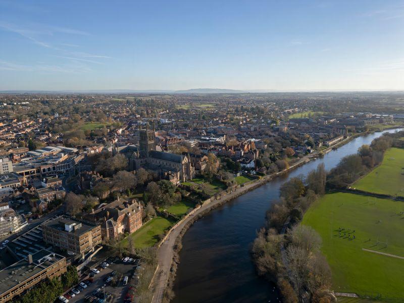
Vodafone announced it is working with several organisations in the River Severn Partnership initiative to provide them with high resolution rainfall data that can inform short-term forecasts, typically covering a period of a few minutes to a few hours, along the River Severn, the longest river in Britain. The same technology is being used in tandem with other monitoring systems in Spain to detect wildfires.
Determining rainfall
Both initiatives leverage Vodafone’s mobile network, demonstrating how its application extends beyond merely connecting individuals’ smartphones. In the case of the River Severn, Vodafone gathers accurate rainfall measurements using data from the microwave links connecting mobile masts. Rain and other forms of precipitation can absorb and scatter microwave signals, and Vodafone can use the change in signal strength to determine rainfall.
Vodafone monitors the performance of these microwave links on average every 15 minutes and adjusts its network to compensate for any loss of connection strength, particularly during heavy downpours. Similarly, Vodafone’s engineers can monitor the dryness of the air, which when combined with low humidity, high temperature and strong winds, can lead to wildfires.
Giant weather gauge
Marika Auramo, CEO of Vodafone Business, explained: “We are turning data collected on the performance of a connection into a giant weather gauge across our pan-European network. This data can be used by local authorities, governments and industry bodies to alert communities of flooding, wildfires, as well as man-made disasters.”
Managing and mitigating flood damage in the River Severn area is estimated to cost £230 million annually. Vodafone is working with specialist company Wireless DNA to monitor mobile signal variations caused by precipitation. This data will be shared with the River Severn Partnership to enhance flood early warning systems and defences, and supplement radar and rain gauge data.
Separately, Vodafone is also working with Starion Technologies, a Belgium-based company that provides engineering services for national infrastructures, to supply critical information to first responders across mainland Europe. Vodafone will provide high-resolution data on ground-level weather conditions and other environmental factors to be integrated into the Safety Platform for Crisis and Emergency (Safeplace) through Starion. This system is financed and overseen by the European Space Agency’s Civil Security from Space programme, with the goal of enhancing Europe’s preparedness during emergencies, particularly environmental crises such as floods, earthquakes, and wildfires.
Flood and wildfire risk maps
Vodafone’s extensive geographical coverage allows it to collect and deliver data across multiple countries, providing weather observation and forecasting experts with both broad and localised views on ground-level weather conditions. When combined with terrestrial weather data and high-resolution satellite images, it enhances flood and wildfire risk maps and models.
Complementing Vodafone’s worldwide Internet of Things (IoT) weather-monitoring environmental sensors, the company is now providing invaluable weather data from its commercial microwave links covering areas that are out of reach of existing weather observation posts. “We are partnering with both private and public sector organisations to create an infrastructure of advanced Earth observations, satellite-based positioning and communications, and Internet of Things data. Together, they provide a major central resource to enhance situational awareness and improve response times during natural disasters,” Marika added.